Demos
Demos  Docs
Docs  Support


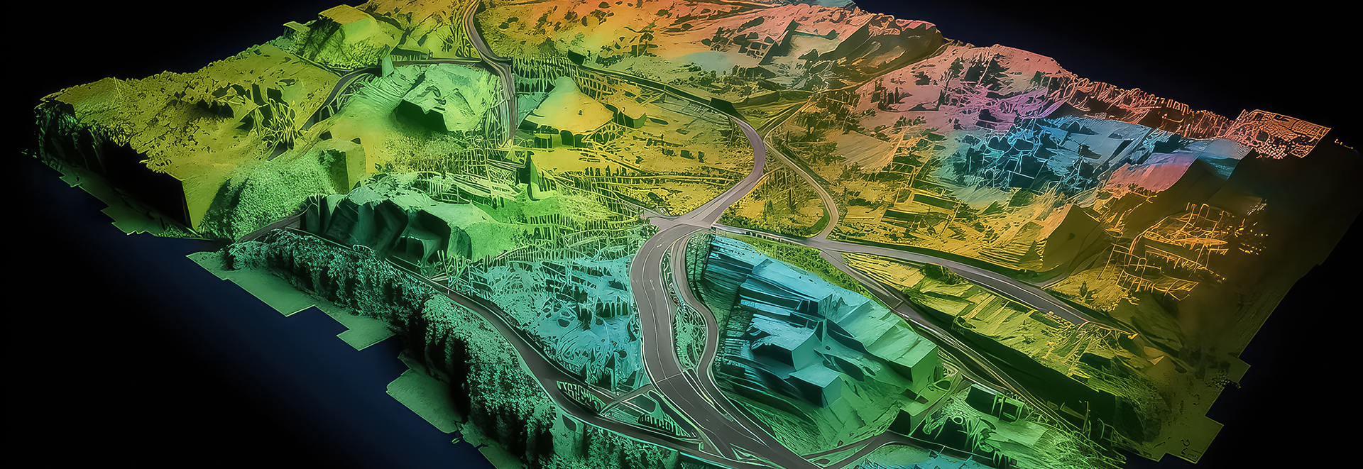
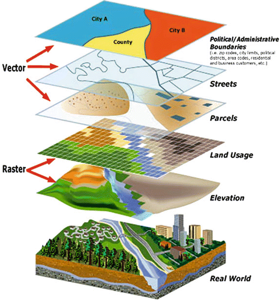
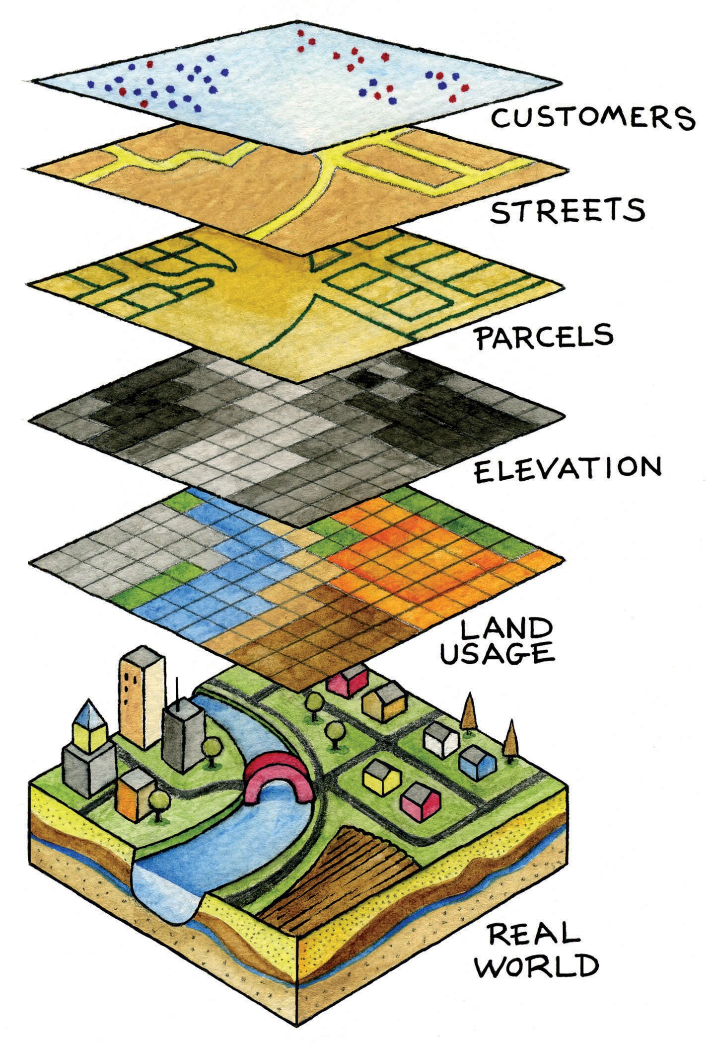
- DEM generation with the help of high resolution satellite Image of area 251 Sq Mtr for GHAT SECTION
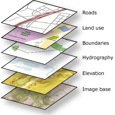
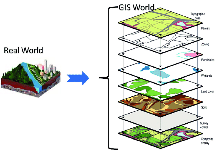
- Preparation and planning of water supply system in 13 cities of Jharkhand on GIS platform
- GIS and LIS customization of cross country slurry pipeline of about 550 km
- Segregation of forestry, habitation, and agriculture or cartosat satellite image
- LU/LC(Land use/Land cover) planning and preparation for US city, MINNEAPOLIS
- Planning of water storage Water shed, Catchment Area & Planning for water storage in the state of Rajasthan on GIS platform
- Preparation of high-tension line Location detail with the technology parameter in the state of Rajasthan
- Generation of drainage pattern for irrigation on Dem for the state of Uttar Pradesh
- Mining plan for Brick links in the state of Haryana
- Remote sensing studies along the alignment corridor with Limited ground checks consisting of interpretation of satellite, collateral and field data for preparation of Thematic maps depicting geological units, geomorphologic maps depicting geomorphic units, lineament/ fracture map showing structural features, detailed drainage and surface water bodies, map portrayal of geological and tectonic features and their significance in planning, design and construction of tunnels, bridges and railway formation. for Misamari (Bhalukpong) - Tenga - Tawang BG single Railway line.(
- Remote sensing studies along the alignment corridor with Limited ground checks consisting of interpretation of satellite, collateral and field data for preparation of Thematic maps depicting geological units, geomorphologic maps depicting geomorphic units, lineament/ fracture map showing structural features, detailed drainage and surface water bodies, map portrayal of geological and tectonic features and their significance in planning, design and construction of tunnels, bridges and railway formation. for Silapathar-Bame -Along(87KM) BG single Railway line in Arunachal Pradesh.
- Remote sensing studies along the alignment corridor with Limited ground checks consisting of interpretation of satellite, collateral and field data for preparation of Thematic maps depicting geological units, geomorphologic maps depicting geomorphic units, lineament/ fracture map showing structural features, detailed drainage and surface water bodies, map portrayal of geological and tectonic features and their significance in planning, design and construction of tunnels, bridges and railway formation for Akola-Khandwa section- and Akot-Amlakhurd section (Phase-III)
- Remote sensing studies along the alignment corridor with Limited ground checks consisting of interpretation of satellite, collateral and field data for preparation of Thematic maps depicting geological units, geomorphologic maps depicting geomorphic units, lineament/ fracture map showing structural features, detailed drainage and surface water bodies, map portrayal of geological and tectonic features and their significance in planning, design and construction of tunnels, bridges and railway formation for New line from Baramulla to Uri (50 Km ) J&K :
- Remote sensing studies along the alignment corridor with Limited ground checks consisting of interpretation of satellite, collateral and field data for preparation of Thematic maps depicting geological units, geomorphologic maps depicting geomorphic units, lineament/ fracture map showing structural features, detailed drainage and surface water bodies, map portrayal of geological and tectonic features and their significance in planning, design and construction of tunnels, bridges and railway formation for New line between Anantnag- Bijbehara- Pahalgam (77.5 km) J&K.
- Remote sensing studies along the alignment corridor with Limited ground checks consisting of interpretation of satellite, collateral and field data for preparation of Thematic maps depicting geological units, geomorphologic maps depicting geomorphic units, lineament/ fracture map showing structural features, detailed drainage and surface water bodies, map portrayal of geological and tectonic features and their significance in planning, design and construction of tunnels, bridges and railway formation for New line between Sopore-Kupwara (33.70 km) J&K
- Remote sensing studies along the alignment corridor with Limited ground checks consisting of interpretation of satellite, collateral and field data for preparation of Thematic maps depicting geological units, geomorphologic maps depicting geomorphic units, lineament/ fracture map showing structural features, detailed drainage and surface water bodies, map portrayal of geological and tectonic features and their significance in planning, design and construction of tunnels, bridges and railway formation for New line between Avantipore-Shopian (27.6 km)
- Aerial Photogrammetry survey through satellite imaginary, Lidar and Drone for Misamari (Bhalukpong) - Tenga - Tawang BG single Railway line.(
- Aerial Photogrammetry survey through satellite imaginary, Lidar and Drone for Silapathar-Bame -Along(87KM) BG single Railway line in Arunachal Pradesh.
- Aerial Photogrammetry survey through satellite imaginary, Lidar and Drone for Akola-Khandwa section- and Akot-Amlakhurd section (Phase-III)
- Aerial Photogrammetry survey through satellite imaginary, Lidar and Drone for New line from Baramulla to Uri (50 Km ) J&K :
- Aerial Photogrammetry survey through satellite imaginary, Lidar and Drone for New line between Anantnag- Bijbehara- Pahalgam (77.5 km) J&K.
- Aerial Photogrammetry survey through satellite imaginary, Lidar and Drone for New line between Sopore-Kupwara (33.70 km) J&K
- Aerial Photogrammetry survey through satellite imaginary, Lidar and Drone for New line between Avantipore-Shopian (27.6 km)